Workin in QGIS, I have a shapefile called "protected areas" of Dominican Republic, that was digitized from topomaps 50k. Shapefile is projected to WGS84, 19N zone. My problem is that when I load openlayers, the limits of almost all protected areas, don't get aligned with openlayers. In the following image there is an example: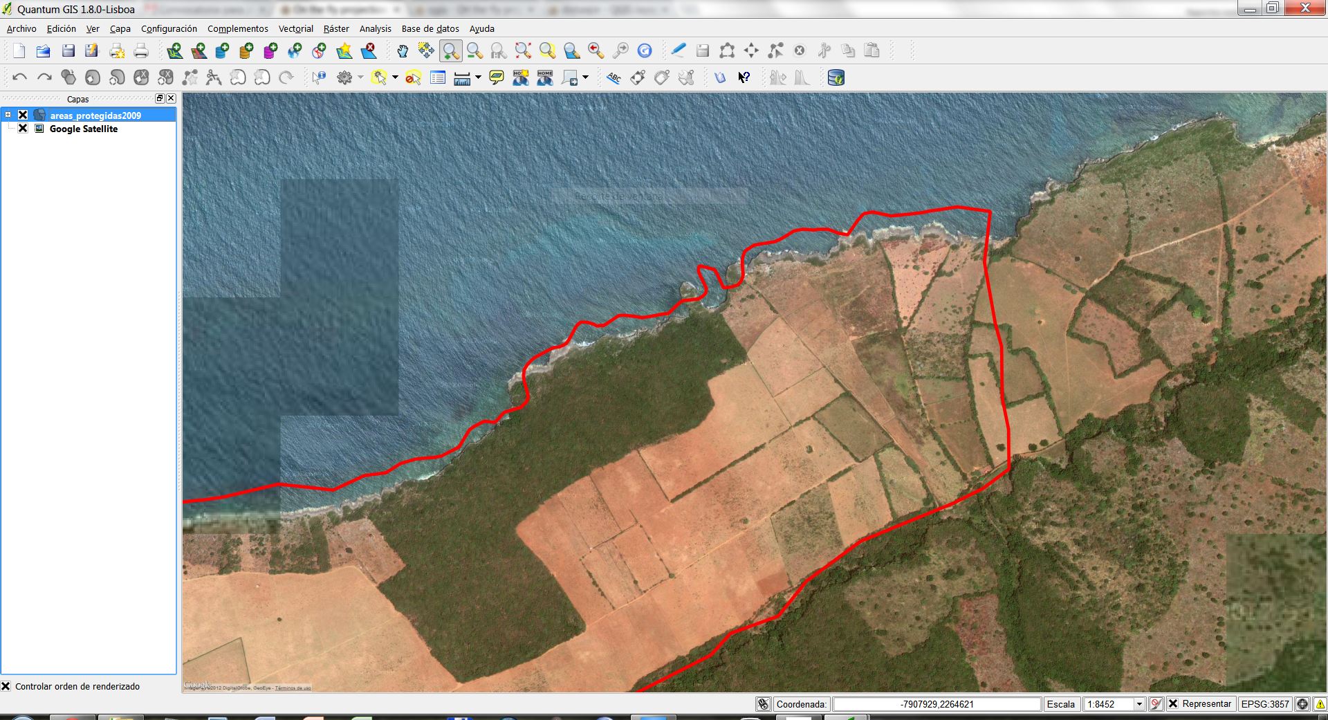
The limit of the protected area (in red) is the coastline; but the real coastline plotted in Openlayers (google satellite) doesn't align with my shapefile (this area has rocky coastline, that haven't changed since topo was made). There is a ca. 45m shift in the X axis, and ca. 50m in the Y axis. In the following image: 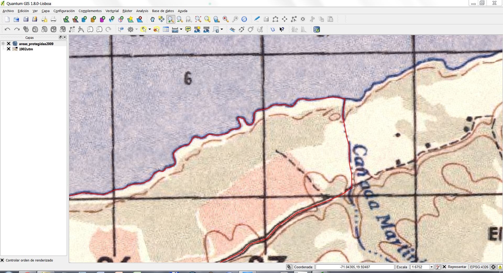
the limit of the protected area is prefectly aligned with topomap (coastline, road, etc.). As I know, OpenLayers is projected using "Web Mercator". So, do I need to define a new CRS with transformation parameters between WGS84 19N and Web Mercator? I believed they use the same ellipsoidal reference, so I shouldn't need to define a transformation.
Any help would be appreciated.
Thanks.
Jose
Best Answer
Offsets by around 100m are in most cases due to different datums used, that is +towgs84 parameter in proj string is different.
You get a list of projections when you enter 19N as filter in Qgis. You have to find the right one...
Paper maps may be older, so you should look for an older reference ellipsoid datum. The older datum should be used when digitizing.
EDIT: I found an interesting article on Dominican grids here: http://www.asprs.org/a/resources/grids/ (2005, December).
EDIT 2: An online resource for DomRep maps: http://www.lib.utexas.edu/maps/topo/dominican_republic/
The GeoPDFs can be converted to Geotiff with Gdal 1.10.0 latest builds. But the quality of cartography is rather poor. You have to live with that. Remember that 50 metres offset are just 1 mmm on a 50.000 topo map.