I want a tile for a region. I have the coordinates. I used a calculator webservice to convert lat/long to z/x/y.
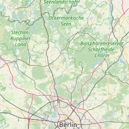
I'm using the OSM service like this: https://tile.openstreetmap.org/8/137/83.png :
curl "https://tile.openstreetmap.org/{8}/{137}/{83}.png" --output out.png
Problem is, this tile does not include detailed names of regions and cities. I can't use a higher zoom level since it reduces my target area. How can I control the details of the request?
I searched the documentation but couldn't find the answers.
Best Answer
It is not possible to influence how these map tiles will look like. These are raster tiles, created by a renderer with a pre-defined stylesheet. Depending on the zoom level and the location, some of them are even pre-rendered.
However, you can switch to a different tile server that uses a stylesheet with more details. For alternative tile servers see the Leaflet Provider Demo or Tiles in the OSM wiki.
Another alternative would be switching to vector tiles where you can influence the style of the map.
Please also make sure to read the tile usage policy for the tile server you are choosing.